


Sortie Montat 1

cps46
User
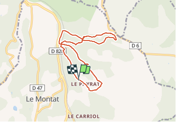

Length
8.1 km

Max alt
276 m

Uphill gradient
233 m
Km-Effort
11.2 km

Min alt
176 m

Downhill gradient
232 m
Boucle
Yes
Creation date :
2024-01-26 16:32:34.0
Updated on :
2024-01-26 17:45:03.603

FREE GPS app for hiking
 SityTrail
IGN / Geographical institutes
SityTrail Plus
The world is yours!
About
Trail of 8.1 km to be discovered at Occitania, Lot, Le Montat. This trail is proposed by cps46.
Positioning
Country:
France
Region :
Occitania
Department/Province :
Lot
Municipality :
Le Montat
Location:
Unknown
Start:(Dec)
Start:(UTM)
377222 ; 4915735 (31T) N.
Comments